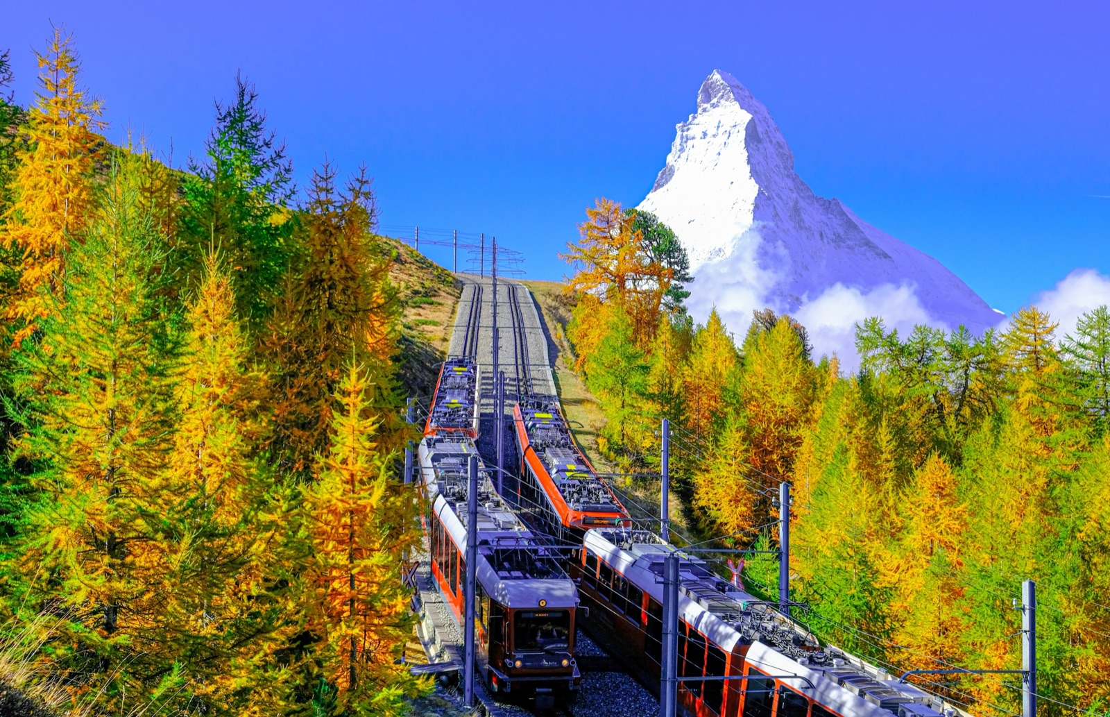
Matterhorn Hikes from Zermatt: Glacier Trail, Five Lakes, Riffelsee and the Hörnli Hut
The best Matterhorn hikes from Zermatt all start with a lift ride up and then walk down or across, with the mountain in front of you. The short classic is the Riffelseeweg from Rotenboden to Riffelberg (about 1 h, 2.9 km, almost all downhill), past the lake that mirrors the Matterhorn. The most famous half day is the 5-lake route from Blauherd to Sunnegga (11.3 km, about 3 h 30 min). For something wilder, the Matterhorn Glacier Trail runs from Trockener Steg to Schwarzsee over ground the ice left behind (6.6 km, about 2 h), and the demanding Hörnliweg climbs from Schwarzsee to the Hörnli hut at 3,260 m, right at the foot of the Matterhorn’s climbing ridge. This guide covers each of them, plus easier walks from the village, and how to choose between them.
How hiking at Zermatt works
Zermatt sits deep in its valley, and the trails with the best Matterhorn views are high above it. Almost every recommended hike therefore uses one of the three lift systems: the Gornergrat railway (to Rotenboden, Riffelberg or the Gornergrat itself), the Matterhorn Express gondola (to Furi, Schwarzsee and Trockener Steg), and the Sunnegga funicular with the lifts beyond it (to Blauherd and the Rothorn). You ride up, walk a route that mostly descends, and either ride down from another station or walk all the way to the village.
Zermatt Tourism’s trail finder listed 73 hiking trails in November 2026, each with a number on the signposts and a grade. The grades follow the Swiss scale: T1 is an easy path, T2 a mountain hiking trail that is moderate, T3 a more demanding mountain path, and T4 an alpine route where you need a sure foot and a head for heights. The numbers in this guide are the tourism office’s own figures for each trail.
The hikes at a glance
| Hike | From – to | Distance | Time | Grade |
|---|---|---|---|---|
| Riffelseeweg (No. 21) | Rotenboden – Riffelberg | 2.9 km | 1 h | T2 |
| 5-lake route (No. 11) | Blauherd – Sunnegga | 11.3 km | 3 h 30 min | T2 |
| Matterhorn Glacier Trail (No. 26) | Trockener Steg – Schwarzsee | 6.6 km | 2 h | T3 |
| Matterhorn Trail (No. 29) | Schwarzsee – Furi | 7.4 km | 2 h | T2 |
| Hörnliweg (No. 27) | Schwarzsee – Hörnli hut | 4.3 km | 2 h 15 min | T4 |
| Zmutt path (No. 2) | Zermatt – Zmutt | 4.3 km | 1 h 35 min | T1 |
| Flower Trail (No. 3) | Blauherd – Sunnegga | 4.6 km | 1 h 20 min | T2 |
| Findlerweg (No. 49) | Sunnegga – Winkelmatten | 3.9 km | 1 h 10 min | T2 |
If you only have one morning and want the best chance of a clear mountain, take the Riffelseeweg early. If you have a full day and decent legs, combine the Glacier Trail with the Matterhorn Trail and walk from Trockener Steg all the way down to Furi.
Riffelseeweg: the Matterhorn in a lake
This is the walk on the postcards. The Riffelseeweg (No. 21) starts at Rotenboden station (2,815 m) on the Gornergrat railway and ends at Riffelberg (2,582 m): about 1 h, 2.9 km, with just 13 m of ascent and 267 m of descent. The Riffelsee itself, at 2,757 m, is not visible from the platform, but it is only about 10 minutes away along a path that drops gently downhill.
On a still morning the Matterhorn stands upside down in the water, alone on the horizon, and it is the most photographed reflection in Zermatt. Zermatt Tourism’s advice is to come when there is no wind; the surface is usually calmest early in the day. A little further on, a second, smaller lake is also very photogenic. Climbers turn off before the lake for the routes on the south face of the Riffelhorn (2,927 m).
Near the end of the walk you reach the Brother Klaus chapel on the Riffelberg, whose shape echoes the silhouette of the Weisshorn. From Riffelberg you can take the train back down, or walk on towards Riffelalp.
Practical points:
- Zermatt Tourism rates the walk suitable for children from 4 years old.
- In spring the path may not be passable because snow is still lying.
- The tourism office’s tip is to ride all the way to the Gornergrat first for the view of 29 four-thousand-metre peaks, then come back down one stop to Rotenboden.
- Return fares from Zermatt (May 2025 to October 2026) were CHF 114 to Rotenboden and CHF 84 to Riffelberg; the half-fare card, GA and Swiss Travel Pass give 50% off.
Our full comparison of the railway and the cable car, with timetables, is in Gornergrat or Glacier Paradise.
The 5-lake route: the hike of superlatives
The 5-lake route (No. 11) is the walk Zermatt Tourism calls the hiking trail of superlatives. It starts at Blauherd (2,571 m), above the Sunnegga funicular, and ends at Sunnegga (2,288 m): about 3 h 30 min, 11.3 km, with 265 m of ascent and 542 m of descent. It is graded T2, moderate, and suitable for children from 6 years.
The lakes, in order, are the Stellisee, Grindjisee, Grünsee, Moosjisee and Leisee. Three of them reflect the Matterhorn in good weather:
- Stellisee (2,537 m) is the famous one, a short walk from Blauherd. Its mirror-like surface is made for photographs.
- Grindjisee (2,324 m) mirrors the Matterhorn and a pair of larches, and the area is rich in alpine flowers.
- Grünsee (2,300 m) is the barren lake, where larches hold on in rubble and sand; it is a good place for a picnic and a swim.
- Moosjisee comes next, on the way down towards Sunnegga.
- Leisee (2,232 m) is Zermatt’s beach, with a playground, barbecue areas and a raft, just below Sunnegga.
Pack swimwear on a hot day: there are swimming spots at the Leisee and Grünsee. One warning from the tourism office is worth repeating. Even when the trail shows as open, the lifts may be partly closed or run only to Sunnegga, so check the lift timetable before you set off, especially early and late in the season.
If the full loop is too long, ride to Blauherd, walk down to the Stellisee and back, and you have the best reflection in under an hour. Or reverse the idea: walk from Sunnegga down to the Leisee for a family afternoon.
Matterhorn Glacier Trail: between rock and ice
The Matterhorn Glacier Trail (No. 26) is the hike for people who want to see what the ice is doing. It runs from Trockener Steg (2,939 m) via Hirli to Schwarzsee (2,583 m): about 2 h, 6.6 km, with 174 m of ascent and 515 m of descent. Walked the other way it takes about 2 h 40. It is graded T3, and Zermatt Bergbahnen calls it one of the more demanding trails in the Zermatt mountains, mainly because of the gravel and rock underfoot.
The route crosses ground that was under the Furgg and Theodul glaciers not long ago. Since the Little Ice Age around 1850 those glaciers have retreated by more than three kilometres, and 23 stations along the way explain what the ice left behind, from moraine and meltwater to the plants that colonise bare rock. Information boards are in German, English, French and Japanese. Look out for the small glacier lakes; the tourism office’s own tip is the reflection of the Matterhorn in the Theodul glacier lake.
The summer season for the trail is June to September. From December to April it is walked as a snowshoe tour with a qualified mountain guide only.
The simplest ticket is the Kombi-Ticket, which covers one ride from Zermatt to Trockener Steg and one from Schwarzsee back down to Zermatt. From Trockener Steg the Matterhorn’s east face rises above the Furgg glacier, framed by the Furggen and Hörnli ridges, and that view stays with you most of the way.
Matterhorn Trail: Schwarzsee down to Furi
If you finish the Glacier Trail with energy left, keep walking. The Matterhorn Trail (No. 29) leaves from the chapel at Schwarzsee and descends via Stafelalp to Furi (1,867 m): about 2 h and 7.4 km, with no ascent at all and 746 m of descent. It is graded T2.
The views here are of the Matterhorn’s north face, the walls around Höhbalmen opposite, the glaciers and, in good visibility, the Dent Blanche. Marmots and chamois are often around, and the flora includes alpine roses and edelweiss. At Furi you can pick up the gondola back to Zermatt or continue on foot.
Glacier Trail plus Matterhorn Trail makes a full, satisfying day: rock and ice at the top, meadows and larches at the bottom, and the mountain in view almost throughout. Descents this long are hard on the knees, so poles help.
Hörnliweg: to the foot of the Matterhorn
The Hörnliweg (No. 27) is the walk that gets you closest to the Matterhorn without climbing it. It runs from Schwarzsee (2,583 m) to the Hörnli hut (3,260 m): about 2 h 15 min, 4.3 km and 693 m of ascent, and the walk back takes about 1 h 30. It is graded T4, demanding.
This is not a stroll. The route is marked and has safety ropes, metal pegs and chains, and in places metal staircases; one staircase has grating treads that hang over nothing, and parts of the path are exposed. Zermatt Tourism recommends it only for hikers with a sure foot and a good head for heights. The first climbers set out on this path on 14 July 1865; of the seven, only three returned.
At the top, the hut sits right under the Hörnli ridge, the standard route to the summit, and you can watch climbers on the ridge from the terrace with binoculars. August to September is the best time to see them. Know before you go:
- The hut is open only in summer, from the end of June until the end of September; its own site gives the 2027 season as 25 June to 18 September 2027.
- Lunch is served from 11:00 to 15:00, first come, first served, without reservations.
- You cannot eat your own food on the terrace or in the restaurant, and the tap water is not drinkable, so carry enough water.
- Wild camping and bivouacking are forbidden around the Matterhorn above 2,880 m.
Schwarzsee is 20 minutes from Zermatt on the Matterhorn Express, including changes. In September 2026 the lift company’s shop listed Schwarzsee tickets from CHF 33.00. Our journal article Climbing the Matterhorn explains what happens above the hut.
Easier walks from the village
You do not need a lift ticket to walk with the Matterhorn in view.
The Zmutt path (No. 2) leaves from Zermatt train station (1,620 m) and climbs gently through forest and meadows to the hamlet of Zmutt (1,937 m): 4.3 km, 339 m of ascent and about 1 h 35 min, graded T1. Coming back down takes about 1 h 10. Zmutt has traditional houses, narrow alleys, good places to eat and a magnificent view of the Matterhorn’s north face.
The Findlerweg (No. 49) is a descent rather than a climb: from Sunnegga (2,288 m) past the Leisee and through the hamlet of Findeln down to Winkelmatten (1,650 m), about 1 h 10 min over 3.9 km with 615 m of descent. Findeln’s terraces, facing the Matterhorn, are one of the best lunch stops in the valley.
The Flower Trail (No. 3) runs from Blauherd via the hamlet of Tufteren to Sunnegga: 4.6 km, 76 m of ascent, 363 m of descent and about 1 h 20 min. Boards explain the flowers growing beside them, edelweiss and gentian among them, and it suits children from 4 years old.
Higher still: the Rothorn
From Blauherd the cable car continues to the Rothorn, whose summit station Zermatt Bergbahnen gives as 3,103 m on its peak page. Locals call it the Matterhorn at its most photogenic. From there the Path to Freedom, which the lift company calls the highest hiking trail in Europe, climbs to the Oberrothorn at 3,415 m. This is a serious high-altitude walk, so take it slowly and turn back if you feel the height. Lower down, the Peak Collection is an outdoor exhibition of 18 sculptures at 2,350 m.
Two bridges for the brave
The Furi suspension bridge, just above Zermatt, is 100 m long and crosses the Gorner gorge 90 m above the ground. Zermatt Tourism suggests it as a trial before the big one.
The big one is the Charles Kuonen bridge near Randa, down the valley. At 494 m it is the longest pedestrian suspension bridge in the Alps; crossing takes just under 10 minutes, it is 65 cm wide and at its highest point you are 85 m above the ravine. The circular path (No. 69) starts at Randa station (1,439 m), takes about 4 h and covers 8.6 km with 988 m of ascent. Crossing is free. The floor is open grating, so check whether children and dogs will cross it, avoid it in thunderstorms, and note that the bridge is closed in winter: the trail to it closes from 28 October and reopens in spring.
When the trails are open
The high trails open as the snow melts, which is usually from June, and stay open until the first lasting snow in autumn. The Glacier Trail’s summer season is June to September, the Hörnli hut runs from the end of June to the end of September, and paths like the Riffelseeweg can still be under snow in spring. Lift timetables change through the season, and some lifts close for maintenance in late autumn, so always check them before planning a route that ends at a station.
Zermatt Tourism also points out that you can hike in winter on prepared paths away from the ski slopes. Those are different routes from the summer trails above; ask at the tourism office what is groomed.
For the chances of a clear Matterhorn by month and time of day, see When to See the Matterhorn, and check the Zermatt weather page for the forecast before you choose a day.
Tickets for hikers
Three ticket ideas cover most plans:
- Single and return tickets suit one hike. Descend on foot and you only need a single up.
- The Kombi-Ticket for the Glacier Trail covers Zermatt to Trockener Steg and Schwarzsee back to Zermatt.
- The Peak Pass, from CHF 190 in November 2026, gives unlimited travel as timetabled to Matterhorn Glacier Paradise, Riffelberg, the Rothorn and the Gornergrat, plus the local train between Randa, Täsch and Zermatt and the local bus. It is the better deal if you plan several hikes on different lifts.
With the half-fare card or GA you get 50% off single and return tickets and the Kombi-tickets on Zermatt Bergbahnen, and 25% off the Peak Pass. Children up to 9 travel free on the Peak Pass and children of 9 to 15.99 pay half.
What to carry and how to stay safe
Mountain weather can change within minutes, from cloud to clear sky or from sunshine to fog, and the Gornergrat railway advises always preparing for any weather. Zermatt Tourism’s safety rules for every trail are short and worth following:
- Plan every route carefully and adapt it to your own fitness, the weather and the season.
- Take suitable clothing, enough food and water, and turn back in time if the weather looks uncertain.
- Tell someone your route and, if possible, never walk alone.
- Stay on marked trails and never go onto a glacier without a mountain guide.
- Watch for warning signs below dams and water intakes, where rivers can rise suddenly.
On top of that, wear proper boots with grip, carry a rain jacket even on a bright morning, and bring sun cream and sunglasses: the light at 3,000 m is strong. Starting above 2,500 m is a big jump for most people, so take the first day gently. If anything goes wrong, the lift company gives Mountain Rescue as +41 27 966 01 44 and Air Zermatt as 144.
Choosing your hike
- Short on time, want the photo: Riffelseeweg, early in the morning.
- Families: the Leisee and the Flower Trail; the 5-lake route for children from 6 years.
- Glaciers and geology: the Matterhorn Glacier Trail, then the Matterhorn Trail down to Furi.
- Close to the mountain: the Hörnliweg, only with a sure foot and a head for heights.
- No lift ticket: the Zmutt path from the station.
- Thrills: the Furi bridge, then the Charles Kuonen bridge near Randa.
If you would rather go up with someone who knows the mountain, guided options are on our tours page. For getting to Zermatt in the first place, read How to Get to Zermatt.
Frequently asked questions
What is the best easy Matterhorn hike?
The Riffelseeweg from Rotenboden to Riffelberg: about 1 h and 2.9 km, almost all downhill, with the Matterhorn reflected in the Riffelsee. The Zmutt path from the village is the easiest walk that needs no lift.
How long is the 5-lake walk in Zermatt?
It is 11.3 km from Blauherd to Sunnegga and takes about 3 h 30 min, with 265 m of ascent and 542 m of descent.
Can you hike to the Matterhorn?
You can hike to its foot. The Hörnliweg climbs from Schwarzsee to the Hörnli hut at 3,260 m in about 2 h 15 min. It is graded demanding (T4), with exposed sections, ropes and metal staircases. Above the hut is climbing terrain for mountaineers with a guide.
Is the Matterhorn Glacier Trail hard?
It is graded T3 and the lift company calls it one of the more demanding trails, mainly for its rocky, gravelly ground. It is 6.6 km and about 2 h from Trockener Steg to Schwarzsee, and mostly downhill.
When can you hike in Zermatt?
The high summer trails are generally open from June to September, depending on snow. The Glacier Trail’s season is June to September, and the Hörnli hut opens from the end of June to the end of September. In winter there are prepared winter walking paths instead.