Reference
Where Is the Matterhorn? Location, Height, Faces and Viewpoints
The Matterhorn is on the border between Switzerland and Italy, in the Alps. On the Swiss side it rises above Zermatt, at the head of the Matter Valley in the canton of Valais; on the Italian side it rises above Breuil-Cervinia, at the head of the Valtournenche valley in the Aosta Valley. The summit ridge runs exactly along the national border, and the summit cross stands on the so-called Italian summit.
It is 4,478 m high. The usual base is Zermatt, which is car-free and reached by train, about three and a half hours from Zurich Airport. From the Italian side it is known as the Cervino, and the two base villages are linked by cable car over the glaciers east of the peak. This article explains where the mountain is, how high it is, how its faces and ridges are arranged, what it is made of and where to see it from.
The short answer
- Countries: Switzerland and Italy. The border follows the summit ridge.
- Regions: the canton of Valais in Switzerland and the Aosta Valley in Italy.
- Mountain range: the Valais Alps, at the end of the Matter Valley.
- Nearest villages: Zermatt on the Swiss side, Breuil-Cervinia on the Italian side.
- Height: 4,478 m, the figure on the maps. A GPS survey measured 4,477.54 m.
- Names: Matterhorn in German, Cervino or Monte Cervino in Italian, Le Cervin in French; locally ds Hore in Zermatt and Gran Becca in the Aosta Valley.
Switzerland or Italy?
Both. The Matterhorn stands on the main Alpine watershed, and the border runs along its summit ridge. According to Zermatters, a Zermatt guide company, the summit cross stands on the so-called Italian summit.
The mountain has four faces, each roughly facing one of the four points of the compass. Three of them, the north, east and west faces, are on the Swiss side. The south face is on the Italian side. That is why the familiar view, the steep pyramid of the east and north faces, belongs to Zermatt, while Breuil-Cervinia looks up at the south face.
The two valleys have long been connected. Just east of the Matterhorn is the Theodul Pass, the main passage between them and a trade route since Roman times. The Matterhorn Museum in Zermatt shows Theo, a mercenary from the sixteenth century who failed to cross the Theodul Pass. Today the crossing is made by cable car: the Matterhorn Alpine Crossing crosses the border at nearly 3,500 metres, and at Testa Grigia you can stand with one foot in Switzerland and the other in Italy.
The two base villages
Zermatt (Switzerland)
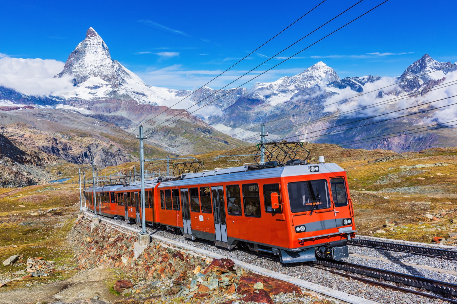
Zermatt is the main base for the Matterhorn and the starting point for the Gornergrat railway, the Glacier Paradise cable car and the Sunnegga funicular. The Gornergrat railway’s valley station, in the centre of the village, is at 1,604 m.
Zermatt is car-free. Trains run there every half hour, about three and a half hours from Zurich Airport and four hours from Geneva or Basel airports. If you drive, you park at Täsch and take the shuttle train, which runs every 20 minutes and takes 12 minutes. Our guide to getting to Zermatt has the details.
Breuil-Cervinia (Italy)
Breuil-Cervinia, usually just called Cervinia, is a modern resort at the foot of the Matterhorn, at 2,000 metres at the top of the Valtournenche valley. It is 52 km from Aosta, according to the Aosta Valley tourist board. By car you leave the A5 Turin-Aosta motorway at Châtillon/Saint-Vincent and follow the regional road for 28 km. The Italian lift company gives the drive from Milan Malpensa as 2 hours 16 minutes (171 km), and from Geneva Airport as 3 hours 37 minutes (260 km).
No road crosses the mountains between the two villages. Our article on Cervinia covers the Italian side in detail.
Crossing between the Swiss and Italian sides
Since 1 July 2023 the two villages have been linked by cable car, so you can cross without skis. The route, sold as the Matterhorn Alpine Crossing, climbs from Zermatt via Furi, Schwarzsee and Trockener Steg to Matterhorn Glacier Paradise, crosses to Testa Grigia on the border, and comes down via Cime Bianche Laghi and Plan Maison to Breuil-Cervinia. The trip takes about 90 minutes.
The border station at Testa Grigia, at 3,458 m, was built right on the Italian border but entirely on Swiss soil. In September 2026 Zermatt Bergbahnen listed the crossing from CHF 147.50, and Cervino S.p.A., the Italian lift company, says the route will be closed for maintenance from 7 January to 26 February 2027. The Italian lifts also pause between their summer and winter seasons, so check fares and dates on both sides before you go.
Which side should you visit?
For a first visit, Zermatt is the easier base: it has direct trains, three separate lift systems to viewpoints, and the classic view of the east and north faces. Breuil-Cervinia is closer to Milan and Turin, is reached by road, and shows you the less familiar Italian side of the mountain. With the cable car between them you do not have to choose; a day trip across the border lets you see the Matterhorn from both countries.
How high is the Matterhorn?
The Matterhorn is 4,478 m high. That is the figure on Swiss maps, and the one Zermatt’s tourist board and lift companies use.
The height has since been measured more precisely. According to an article in Leica Geosystems’ customer magazine, which quotes Switzerland’s federal mapping office, the mapped figure goes back to the 1920s, when the summit was surveyed at 4,477.50 m and entered on Swiss maps as 4,478 m. In September 1999 the Italian geology professor Giorgio Poretti took a GPS survey system to the summit for the first time. The result was 4,477.54 m, which still rounds to 4,478 m, so the maps did not change.
The Matterhorn is not the highest mountain nearby. Monte Rosa, almost directly opposite, is almost 170 metres higher. The Matterhorn’s fame comes from its shape: Zermatt Tourism says there is no better-known mountain whose natural form is so close to a pyramid, and its free-standing position makes that shape visible from all sides.
Four faces and four ridges
The faces are separated by four ridges, and each ridge has its own name and history.
| Ridge | Runs between | Notes |
|---|---|---|
| Hörnli | North and east faces | The Swiss normal route, climbed from Zermatt on the first ascent in 1865 |
| Lion (Leone) | South and west faces | The Italian normal route, from Breuil-Cervinia |
| Zmutt | North and west faces | Rarely climbed; harder than the normal routes |
| Furggen | East and south faces | Rarely climbed; harder than the normal routes |
Zermatt Tourism describes the Hörnli as the Swiss north-east ridge and the Lion as the Italian south-west ridge. From the Swiss viewpoints, the Hörnli is the ridge running up towards the summit between the two faces you see. At Trockener Steg, on the way to Glacier Paradise, the east face rises above the Furgg glacier, framed by the Furgg and Hörnli ridges.
Climbers use all four ridges in summer and early autumn, but the Zmutt and Furgg ridges are rarely climbed because they are harder than the two normal routes. Our article on climbing the Matterhorn covers the Hörnli and Lion routes and the story of the first ascent.
Matterhorn, Cervino, Cervin: where the names come from
The mountain has more names than most, because it stands between languages.
- Mons Silvus. Zermatt Tourism says the mountain first appears in medieval documents under this Latin name, which later became Mons Servinus and Mons Servin.
- Cervin and Cervino. The name finally became Cervin in French and Cervino in Italian. The mountain was first written down as Mont Cervin in 1581.
- Matterhorn. The German name first appears in 1682. It probably comes from Matte, meaning meadow, after the grassy valley where Zermatt, zur Matt, now stands. Horn describes the peak.
- Local names. In Zermatt dialect the mountain is ds Hore, the peak; in Upper Valais dialect ds Horu. In the Aosta Valley it is the Gran Becca.
In Italian it is Monte Cervino or simply Cervino; in French, Le Cervin.
A mountain made in Africa
The most surprising fact about the Matterhorn is geological. In 2004 the Swiss federal geology office published the Matterhorn sheet of the Geological Atlas of Switzerland, and its announcement opened with a single sentence: the pyramid of the Matterhorn consists of African rocks and sea-floor deposits.
The explanation, as the office tells it, goes back 100 million years. At that time an ocean, the Tethys, lay between the European and African plates, and volcanoes on its floor covered the sea bed with volcanic rock. As the African plate moved towards Europe, it pushed sediments and volcanic rock from the ocean floor ahead of it. When the two plates collided, 45 million years ago, the African plate and those sea-floor rocks were pushed up over the edge of the European plate, and the folding of the Alps began.
The result is a mountain in layers. The summit of the Matterhorn is of African origin, like those of the Dent Blanche and the Weisshorn, sitting on top of ocean-floor rocks. Around Zermatt, pillow lava is evidence of the volcanic activity on that ancient sea floor.
Glaciers around the Matterhorn
The Matterhorn’s sharp shape was carved by ice. Several glaciers diverge from the peak and have eroded its sides, such as the Matterhorn Glacier at the base of the north face. That is the glacier on which three of the four climbers killed on the first ascent in 1865 were found.
Other glaciers are easy to see from the lifts:
- The Furgg glacier lies below the east face, and is in full view from Trockener Steg.
- Matterhorn Glacier Paradise, at 3,883 m, stands among glaciers. Its platform looks out over 38 four-thousand-metre peaks and 14 glaciers in three countries.
- The Plateau Rosà and Ventina glaciers on the Italian side carry Cervinia’s summer ski runs.
In summer the ice around Matterhorn Glacier Paradise is also a ski area: summer skiing there runs from 4 May to 31 October 2026.
The Matterhorn, the Klein Matterhorn and Glacier Paradise
A common source of confusion: the cable car does not go up the Matterhorn. Matterhorn Glacier Paradise, at 3,883 m, stands on the Klein Matterhorn, the Little Matterhorn (Piccolo Cervino in Italian), a separate peak east of the Matterhorn above the glaciers on the border. From its platform the Matterhorn is a neighbour, seen from the side.
The same goes for the Matterhorn Express cable car, the Matterhorn Glacier Trail and the Matterhorn Museum: they are named after the mountain, not built on it. The only way onto the Matterhorn itself is to climb it.
The best places to see the Matterhorn
You can see the mountain from Zermatt itself, but the lifts bring you higher and closer. These are the main viewpoints, with heights from the lift companies.
| Viewpoint | Side | Height | What you see |
|---|---|---|---|
| Zermatt village | Swiss | 1,604 m (station) | The peak above the rooftops, best at sunrise and sunset |
| Gornergrat | Swiss | 3,089 m; platform 3,131 m | The classic view across the valley; a panorama of 29 peaks over 4,000 m |
| Rothorn | Swiss | 3,202 m | Called surely the best view of the Matterhorn by Zermatt Bergbahnen |
| Blauherd | Swiss | around 2,571 m | A sunny plateau on the way to the Rothorn |
| Schwarzsee | Swiss | 2,583 m | The mountain rising almost vertically above the lake |
| Trockener Steg | Swiss | 2,939 m | The east face above the Furgg glacier |
| Matterhorn Glacier Paradise | Swiss | 3,883 m | The highest viewpoint, beside the Matterhorn |
| Plateau Rosà / Testa Grigia | Border | 3,458 m (station) | The Italian side, Mont Blanc and Monte Rosa |
| Lago Blu | Italian | near Cervinia | The Matterhorn reflected in a small lake |
A few notes:
- Gornergrat and Glacier Paradise are the two big viewpoints. Our guide to Gornergrat or Glacier Paradise compares them, including fares.
- Blauherd and the Rothorn are reached via Sunnegga, the shortest lift ride from Zermatt. Zermatt Bergbahnen says locals reckon the Rothorn shows the mountain’s most photogenic side.
- Plateau Rosà is on the Italian side of the Matterhorn Alpine Crossing. Cervino S.p.A., the Italian lift company, says its terrace looks from the Matterhorn to Mont Blanc and from Gran Paradiso to Monte Rosa, as far as Monviso in Piedmont.
- Lago Blu is a small spring-fed lake about 30 minutes’ walk from the centre of Breuil-Cervinia, where the mountain is mirrored in the water when the clouds allow.
How close can you get without climbing?
The closest a walker can get is the Hörnli hut, at 3,260 m at the foot of the Hörnli ridge. Zermatt Tourism says that at the hut you can feel, touch and experience the Matterhorn, which towers over it. The trail from Schwarzsee is graded demanding (T4) and takes about 2 h 15 min, with exposed sections and metal staircases; our article on climbing the Matterhorn describes it.
For a gentler close-up, Schwarzsee itself, at 2,583 m and 20 minutes from Zermatt by cable car, lies below the north face, with the mountain rising almost vertically above the lake. Walkers with more time can go all the way round: the Tour du Cervin, a high-level trek around the Matterhorn, takes about 8 days, according to Cervino S.p.A.
Seeing it on a short visit
The Matterhorn is often wrapped in cloud, so where it is matters less than when you look. From Zermatt, a clear morning is the time to go up; our guide on when to see the Matterhorn covers seasons, cloud and the best time of day.
If you only have a day, guided day trips run from Lake Geneva: the Geneva trip takes about 13 hours with free time in Zermatt, and the Lausanne tour about 11.5 hours with the Glacier Paradise cable car as an option. Tickets for the Gornergrat railway and other options are on the tours page.
Frequently asked questions
Which country is the Matterhorn in?
Both Switzerland and Italy. The border runs along the summit ridge; the north, east and west faces are in Switzerland and the south face is in Italy. The summit cross stands on the so-called Italian summit.
How high is the Matterhorn?
4,478 m, the figure on the maps. A GPS survey in September 1999 measured 4,477.54 m, which still rounds to 4,478 m.
What is the nearest town to the Matterhorn?
Zermatt, in the canton of Valais, on the Swiss side. On the Italian side the nearest village is Breuil-Cervinia in the Aosta Valley. The two are linked by the Matterhorn Alpine Crossing cable car in about 90 minutes.
Is the Matterhorn the highest mountain in the Alps?
No. Monte Rosa, almost directly opposite, is almost 170 metres higher, and Mont Blanc is higher still. The Matterhorn is famous for its pyramid shape and free-standing position rather than its height.
Can you see the Matterhorn from Italy?
Yes. From Breuil-Cervinia and Lago Blu you look up at its Italian side, where it is called the Cervino, or locally the Gran Becca, and from the Plateau Rosà terrace on the border you see it alongside Mont Blanc and Monte Rosa.
Is the Matterhorn really African?
Its summit is. The Swiss federal geology office explains that the pyramid consists of African rocks and sea-floor deposits, pushed up over the edge of the European plate when Africa and Europe collided 45 million years ago.